Coastal Science and a Low-Cost, DIY Ultrasonic Water Level Sensor
In this guest post, Grace Lower writes about low-cost, open source DIY water level sensors, their role in coastal science education and potential for flood alerts in coastal communities.
Introduction
Coastal science is a field that morphs oceanography, geology, chemistry, biology, physics, and engineering into a broad sector of environmental science specific to Earth’s coastal regions. Now more than ever, coastal science is proving vital as climate change threatens coastal communities with rising sea levels, increasingly intense storms, record-breaking ocean temperatures, and damaged ecosystems. The downstream effects of these risks are innumerable—a notable threat being more frequent and extreme natural disasters like floods. Even sunny day floods—that is, flooding from high tides in the absence of severe weather—are increasing as sea level continues to rise. The detriments of coastal flooding extend beyond the nuisance of excess water, as coastal flooding can:
- Produce life-threatening situations (e.g. driving / walking / swimming in dangerous floodwaters, exposure to contaminated waters, etc.);
- Create economic burden and damage property;
- Hurt natural ecosystems, crops, and livestock;
- Overflow wastewater ponds, which leaches disease-causing microorganisms and chemicals into drinking and ground water; and
- Generate runoff from farms, golf courses, and other areas that use fertilizers, which can lead to algal blooms (in turn, affecting aquatic food webs).
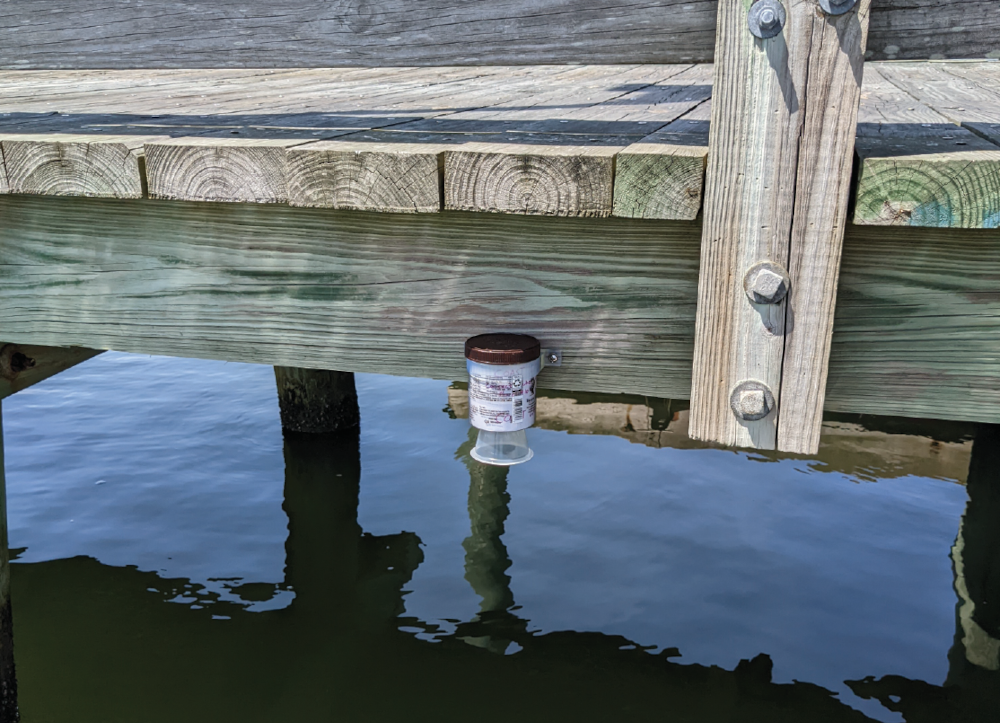
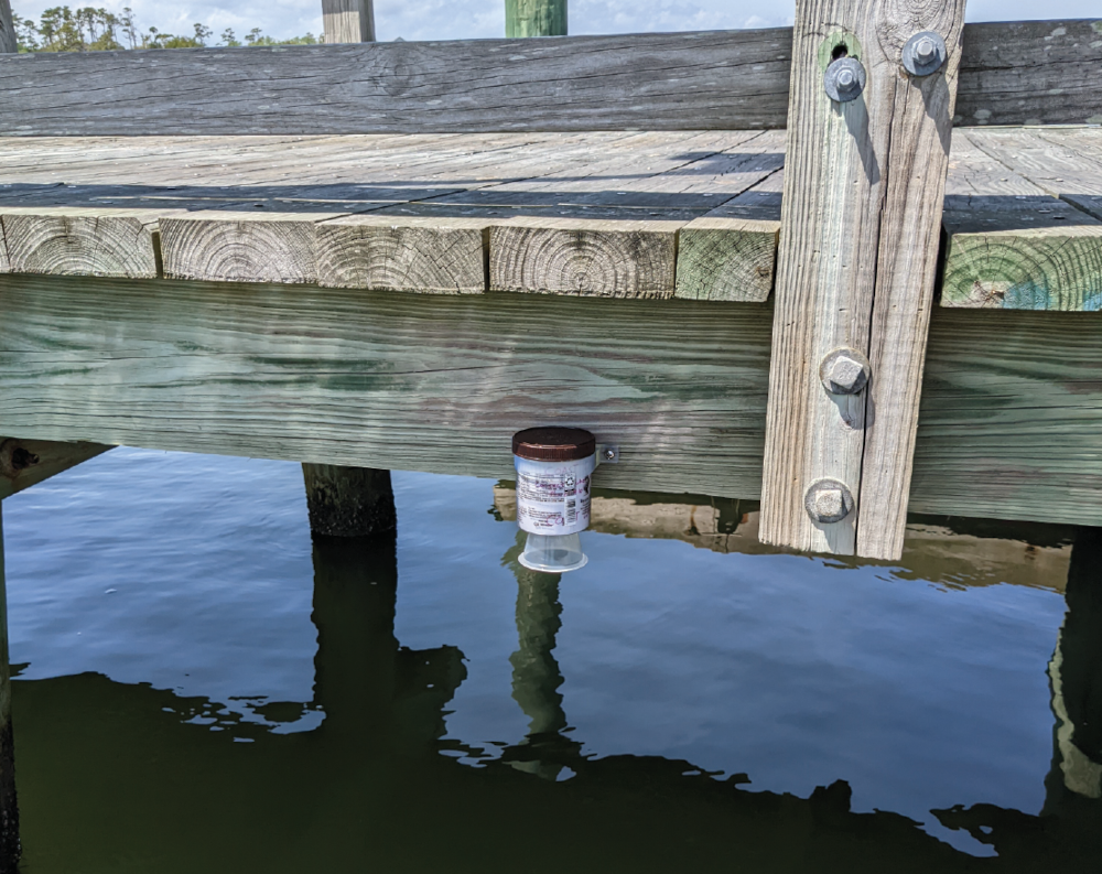
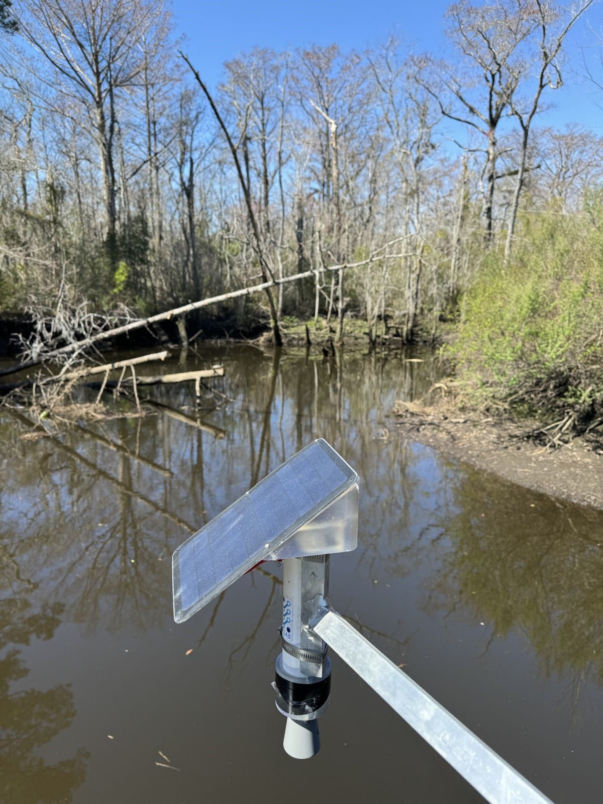
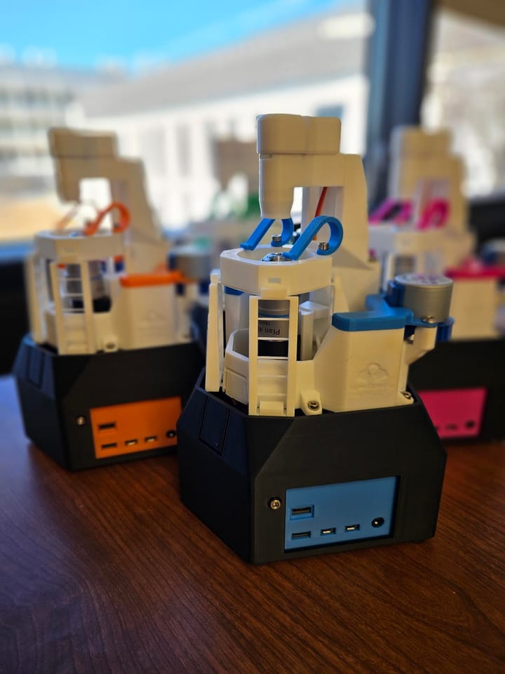
With these risks in mind, it’s clear that monitoring changing water levels and flood risk is essential in empowering coastal communities. Ultrasonic sensors provide a robust method of measuring water levels but have historically been inaccessible in education or community settings due to their high costs and required expertise. However, a low-cost, do-it-yourself (DIY) ultrasonic water level sensor has been developed by Dr. Phil Bresnahan’s COAST Lab initially at Scripps Institution of Oceanography and now at the University of North Carolina Wilmington for use in research, education, and participatory science. The project’s open-source nature and low-cost components, with central focuses on research, education, and community engagement, make it an exciting prospect for the future of participatory coastal science.
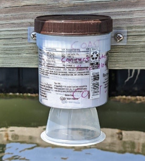
Low-cost, DIY ultrasonic water level sensor
It’s important to understand what is meant by an “in-situ ultrasonic sensor” to grasp why this device is useful, and why the development of a low-cost DIY version is significant. First, in-situ testing refers to measuring a variable in its natural location. Second, an ultrasonic sensor uses a transducer to direct ultrasonic sound waves at an object whose relative proximity is to be measured.
In the context of water level testing, a water body's surface (i.e. the surface of a creek, bay, lake, etc.) is the object whose proximity is being measured. The sensor records the time it takes for the ultrasonic pulse to reflect off the water and return to its receiver. By comparing this time against a known speed of sound, the device calculates the distance between the sensor and surface. When a sensor is properly surveyed in—that is, its absolute height is accurately known—distance between the sensor and water can be easily converted to a water level.
Put simply, using an in-situ ultrasonic sensor is an efficient way to measure water level by measuring a water surface’s position relative to the sensor’s position. The differences between these values are collected to track changes in the water’s level over time.
Sensor’s Role in Participatory Science
It’s important to note that using in-situ ultrasonic sensors to quantify water level is not a new concept; rather, this methodology already exists and is known to be effective. The DIY sensor is unique in that its total cost is much lower than traditional models, with its components at a sum cost of ~375 USD. Furthermore, its open-source, easy-to-understand procedures were designed with users of various experience levels in mind. The idea of participatory science is gaining momentum in the scientific world, as including communities in environmental research can spread interest in safe environmental practices, sources and risks of anthropogenic climate change, and addressing coastal flood events. As detailed in the published article accompanying a prior version of the low-cost sensor (DIY OCEANOGRAPHY • A Low-Cost, DIY Ultrasonic Water Level Sensor for Education, Citizen Science, and Research) ...
“For just over $100, only a small amount of soldering, and installation of ready-to-use code, other students and educators, communities in need of water level monitoring, and potentially researchers can construct a simple but reliable device. Building, deploying, and analyzing data from the sensor can aid in students’ understanding of water level measurements and in the practice of monitoring sea level changes. Ultimately, we believe that this DIY water level sensor can improve ocean and climate literacy while providing a hands-on project that teaches real-world engineering and science skills.”
Future Directions
Next steps for this project include:
- Continuing to build improved versions of the sensor for ease-of-use, efficiency, and low cost;
- Deploying different versions to test durability and accuracy in the field;
- Integrating cellular data into real-time data dashboards and flood alert infrastructure in collaboration with community partners;
- Connecting with additional community partners, researchers, and educators who may benefit from this low-cost sensor;
- Educating the public on the causes and risks of rising water levels—and empowering people to take precautions and practice environmental stewardship.
More Information
Be sure to browse the COAST Lab’s Open Water Level GitHub repository for more information on the low-cost DIY sensor and for access to the open-source program. Additionally, the published journal article featuring the process of developing and testing the early-version sensor (DIY OCEANOGRAPHY • A Low-Cost, DIY Ultrasonic Water Level Sensor for Education, Citizen Science, and Research) can be found here.
Special thanks to Dr. Phil Bresnahan and members of the COAST Lab for their research and contributions, and to IO Rodeo for the opportunity to spotlight this endeavor.
Resources
To learn more about coastal science, water level monitoring, flooding and climate change, and the groundbreaking work being done by the COAST Lab and other organizations, check out the resources below.
The COAST Lab
 COAST-Lab
 Philip Bresnahan
Sunny Day Flooding Project (NC)
Sunny Day is a team of researchers from the University of North Carolina at Chapel Hill (UNC-Chapel Hill) and NC State University (NCSU) working with communities and employing low-cost, open-source methodology to measure, model, and better understand the causes and impacts of chronic flooding in coastal North Carolina.

Anatomy of a flood is an article published by The Washington Post that details coastal flooding in Carolina Beach, NC. Researchers of Sunny Day Flooding Project and their work are referenced.
FloodNet (NYC)
FloodNet is a cooperative of researchers, communities, and government officials in New York City developing and employing low-cost, open-source sensors to measure frequency and depth of street-level flooding in NYC.


Commercial Sensors
The low-cost, DIY water level sensor described here has been shown to perform very well in a range of conditions and is well-suited for community and education applications. However, we wish to acknowledge that there are many vetted commercial options which may have their own advantages. Several examples include:
Hohonu | Green Stream | Campbell Scientific
Additional Resources


Comments ()